Explainer: How does Pars-1 satellite boost Iran's remote sensing capabilities?
By Ivan Kesic
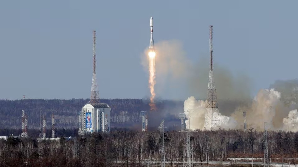
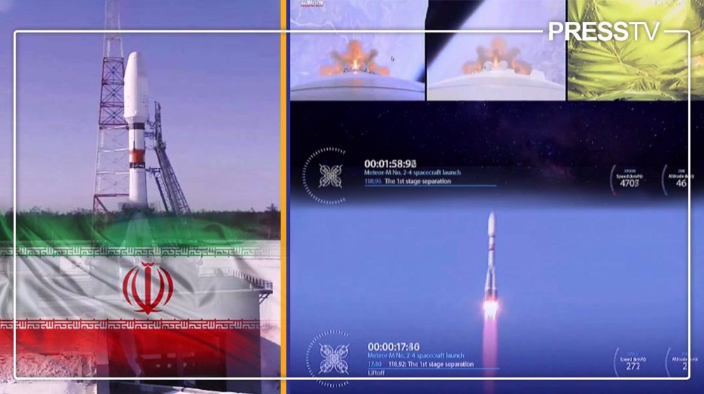
Iran's Pars-1 remote sensing satellite was launched into space by a Soyuz-2 rocket from the Vostochny Spaceport in Russia’s Far East on Thursday, marking another significant breakthrough in the country’s space program.
Issa Zarepour, Iran's minister of communications and information technology, said Pars-1 will be added to the country's sensing satellites and images and data sent by it will be used for multiple purposes.
Zarepour announced the launch on Wednesday, noting that in order to develop international interactions, this satellite will be launched into orbit aboard the Russian rocket Soyuz.
He described the Pars-1 satellite as "100% Iranian” built by domestic knowledge-based companies, adding that a total of 13 satellites have been launched by Iran in the last two years, including three satellites simultaneously last month.
What is the development history?
The Pars-1 satellite is a long-running project of Iranian scientific organizations and was first announced in the early 2010s as Pars Sepehr, together with the related remote sensing satellite Pars-2.
In 2011 and 2012, the then-president of the Iranian Space Agency (ISA) announced the Pars Sepehr and Pars-2 projects as remote sensing satellites, stating that their development would take four years and that they would be launched at an altitude of about 600 km.
The only known capability at that time was relatively stronger recording capabilities compared to the experimental satellites Amir Kabir, Navid and Zafar
The Pars-2 project was led by the Satellite Research Institute, aka Space Research Institute (SRI), working under the Space Research Center of ISA and pursuing the objectives and responsibilities of the Ministry of Science, Research and Technology.
Another important organization involved in the project was the Iran Electronics Industries (IEI or SAIran), also responsible for designing and developing the first indigenously produced satellite of Iran, named Omid, which was launched in early 2009.
At the end of 2014, the deputy head of the ISA mentioned the Pars in the context of three satellites that are being prepared for launch by a new and more powerful launch vehicle, in other words, Simorgh.
Due to changes in governments, personnel and space program priorities, as well as initial difficulties with the Simorgh carrier rocket, the launch of Pars-1 was repeatedly announced and delayed.
In 2017, after the first failed launch of Simorgh, the then director of ISA announced that the Pars is the last among five satellites on the agenda for launching.
Pars was then described as the newest Iranian satellite initiative, still in the conceptual phase, with design and construction elements just beginning under a consortium of Iranian universities across the country.
Two years later, the head of the Iranian Space Research Center announced a plan to launch the Pars satellite by March 2020, which was not implemented due to difficulties with the Simorgh carrier rocket.
The launch of the Pars satellite was announced several more times, including last year when the construction phase of the Pars-2 was revealed, as well as the design phase of the Pars-3, Iran's most advanced remote sensing satellite so far.
Iran has successfully put into orbit homemade research satellite "Pars 1" pic.twitter.com/g5rl7UUisK
— Press TV 🔻 (@PressTV) February 29, 2024
What are its technical specifications?
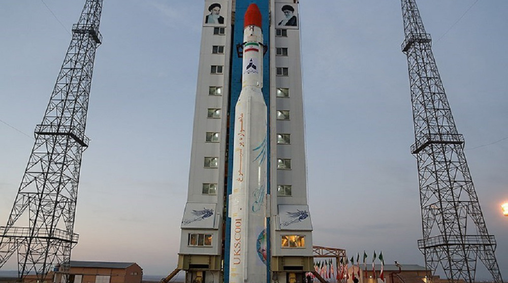
Three weeks before the launch, various technical details of the Pars-1 satellite were published in the Iranian media, including claims that it would be launched with the Simorgh carrier rocket.
After several unsuccessful launches and problems with the final stages, Simorgh proved reliable in January when it successfully launched three Iranian satellites simultaneously.
Leaving no room for risk, due to the complexity, long development time and high cost of the project, the launch was nevertheless done using the more seasoned Russian Soyuz-2 carrier rocket.
Pars-1 is cubic in shape, has a mass of 134 kg and will orbit the Earth at an altitude of 500 km for at least three years, sending recorded material to stations in Charmshahr near the capital Tehran and Mahdasht near the city of Karaj with a rate of 10 Mbps.
UHF/VHF and S bands are used to send commands and receive satellite data with a speed of 30 kbps, and the telecommand and telemetry sending and receiving stations are in the cities of Tehran and Qeshm.
The satellite structure is made of hexagonal honeycomb plates due to their lightweight, high specific bending stiffness and strength under distributed loads, and good energy-absorbing capacity.
To reduce the vibrations from the carrier rocket, an isolator has been designed, constructed and tested.
To validate the structural design of this satellite, two structural models have been made, and fortunately, the second model has met all the requirements of the test.
The satellite is supplied with electricity from two openable solar arrays and one array connected to the body of the satellite, generating in total more than 200 watts of power and storing the excess in the battery pack.
A spring mechanism has been used to expand the opening solar panels, and a DC motor has been used to control the angular speed of the panel opening.
The satellite's heat control subsystem includes multiple sensors and heaters as well as multi-layer insulation (MLI) to maintain and control the temperature of various equipment in the appropriate temperature range. It also uses a heat pipe.
Given that satellites in low Earth orbit are exposed to significant air drag, the Pars-1 satellite uses four cold gas thrusters of one Newton that control the satellite's orbit.
The gas leakage test in this subsystem is one of the most important functional tests and was performed before and after the vibration tests and during the thermal vacuum test.
The satellite has three cameras, multispectral (MS), short-wave infrared (SWIR) and thermal infrared (TIR), with a spatial resolution of 15, 150 and 300 meters, respectively, and is responsible for imaging the entire land of Iran.
The MS and SWIR payload of this satellite can image 9 percent of Iran's land in less than 100 days, and the TIR payload of the Pars-1 satellite, which enables night imaging, can image the entire land of Iran in less than 45 days.
The MS camera installed on this satellite has the best imaging resolution compared to others built in the country. SWIR and TIR cameras have also been used in this satellite for the first time.
Functional, environmental and electromagnetic compatibility (EMC) tests have been performed on all three satellite cameras of Pars-1, like other satellite subsystems.

What are its objectives?
Pars-1 joined a thousand other observation satellites in space, mostly in low Earth orbit (LEO) of about 500 km, imaging the surface and sending the recorded material to control centers.
During the 2010s, the SRI described the project as mostly meeting civilian needs of the country in the fields of agriculture, natural resources, soil science, urban and rural monitoring, water resources, natural disasters, geomorphology, geology and meteorology.
Among the applications of satellites are calculation of cultivated area, determining the condition of the soil, natural resources and biomass, identification of plant and forest species, monitoring water levels, floods, fires, pollution, volcanoes, natural disasters, oil spills, coastline changes, extent of snow and ice, etc.
Iran is unfortunately exposed to natural and other disasters, and cannot be dependent on foreign remote sensing technology, more expensive and often denied for political reasons.
The primary goals were officially stated to be the creation of a map of the Iranian mainland at a scale of 1:100,000 and a map of the Iranian seas at a scale of 1:200,000.
Thousands of photos are needed for this type of mapping, and it should be noted that such images cost thousands of dollars individually on the global market.
In addition to being designed and produced for practical imaging, the secondary goals include the development of the domestic measurement data market and the development and testing of basic technologies of measurement satellites on the ground.
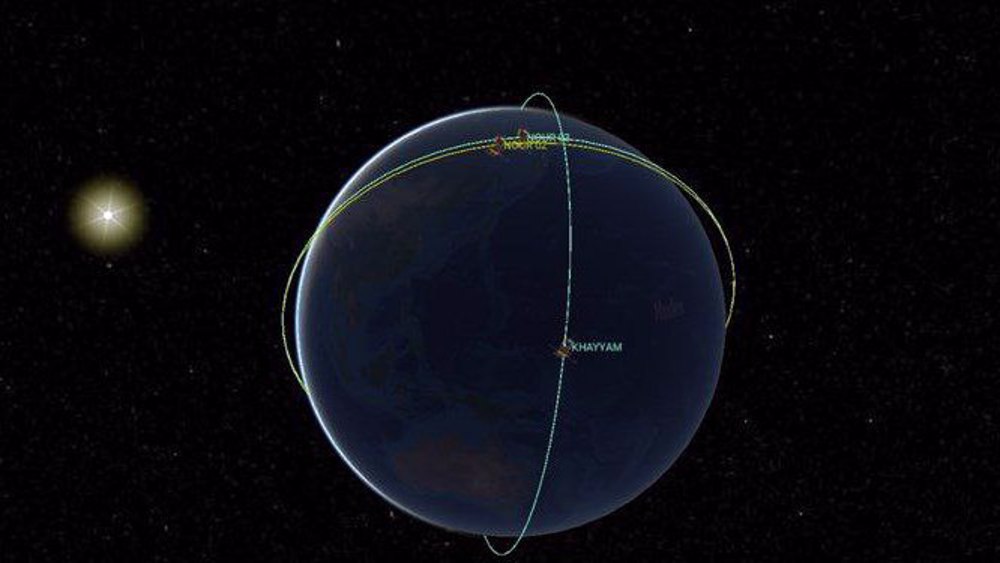
Iran's Nour-2, Nour-3 satellites meet in space over Indian Ocean

Anti-COVID drug may have led to virus mutations: Study
NASA's first major asteroid samples brought to Earth


VIDEO | Pro-Palestine demos spread to Europe as students occupy campus in Paris
Two Palestinians killed by Israeli forces in West Bank
VIDEO | Islamabad rejects US report on rights practices in Pakistan
VIDEO | Yemenis endorse naval forces' attacks on Israeli-linked ships
VIDEO | New national transport strike hits Italy
US to pull out troops from Chad in second African state withdrawal
Yemeni armed forces strike British oil tanker in Red Sea
VIDEO | Genocide in Gaza